Ayuntamiento

Inicio | Ayuntamiento

Contenido reciente


This restaurant is located at the club house at La Cañada Municipal Golf Course. This establishment offers traditional cuisine with fresh top quality market produce. Barbecue meat is also available. The ample terrace features a marvellous view of the Guadiaro River, Sotogrande and Sotogrande Port and Marina.

This tapas bar features rustic decor, has a typical atmosphere, with lots of memorabilia of Holy Week in San Roque and other Andalusian towns. You can savour the best variety of tapas and rations in the emblematic Church Square in the centre of the Old Quarter of San Roque.

This typical bar & restaurant features tapas, rations and three dining-rooms, etc. The establishment is located in the Plaza de Armas Square, in the heart of the monumental Old Quarter of San Roque, the most picturesque town in the Gibraltar Area, with magnificent views of the Strait of Gibraltar, only 5 km from Gibraltar itself and the private resort of Sotogrande. This is an 18th century ancestral home.

'El Depor' is one of the best places to sample the most exquisite fresh fish, sea food and meat in the Gibraltar Area, with generous rations and tapas. The premises feature a rustic style and the walls are decorated with old pictures of the city of San Roque.
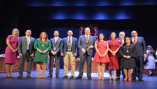
TOMO I. INFORMACIÓN URBANÍSTICA. DIAGNÓSTICO Y OBJETIVOS

AttachmentSize
PDF icon Indice de contenidos232.83 KB
PDF icon INFORMACIÓN URBANÍSTICA. DIAGNÓSTICO Y OBJETIVOS. Información y diagnóstico21.27 MB
PDF icon INFORMACIÓN URBANÍSTICA. DIAGNÓSTICO Y OBJETIVOS. Justificación y objetivos3.94 MB
PDF icon PLANOS DE INFORMACIÓN. 1.- Evolicuón historica de la trama urbana2.36 MB
PDF icon PLANOS DE INFORMACIÓN. 2.- Encuadre en la ciudad. Delimitación2.01 MB
PDF icon PLANOS DE INFORMACIÓN. 3.- Encuadre en la ciudad. Foto aérea2.01 MB
PDF icon PLANOS DE INFORMACIÓN. 4a.- General. Aprobación definitiva PGOU 1987.2.04 MB
PDF icon PLANOS DE INFORMACIÓN. 4b.- General. Aprobación inicial PGOU 2005.3.91 MB
PDF icon PLANOS DE INFORMACIÓN. 5.- Catálogo de protrotección de la edificación.PGOU 1987.584.56 KB
PDF icon PLANOS DE INFORMACIÓN. 6.- Red viar jeranquizada en relación con el sistema viario.2.51 MB
PDF icon PLANOS DE INFORMACIÓN. 7.- Análisis Visual. Recorrido de interés y áreas de valor ambiental.2.74 MB
PDF icon PLANOS DE INFORMACIÓN. 8.- Usos promenorizados1.93 MB
PDF icon PLANOS DE INFORMACIÓN. 9.- Alturas2.36 MB
PDF icon PLANOS DE INFORMACIÓN. 10.- Edad de la edificación1.9 MB
PDF icon PLANOS DE INFORMACIÓN. 11.- Tipología de la edificación2.24 MB
PDF icon PLANOS DE INFORMACIÓN. 12.a- Ocupación2.25 MB
PDF icon PLANOS DE INFORMACIÓN. 12.b- Ocupación por parcelas1.09 MB
PDF icon PLANOS DE INFORMACIÓN. 12.c- Tamaño de patios945.17 KB
PDF icon PLANOS DE INFORMACIÓN. 13- Estado de conservación1.89 MB
PDF icon PLANOS DE INFORMACIÓN. 14- Relación Edificación Vacíos2.21 MB
PDF icon PLANOS DE INFORMACIÓN. 15.- Accesibilidad y Aparcamientos1.66 MB
PDF icon PLANOS DE INFORMACIÓN. 16- Infraestructuras. Abastecimiento de Agua1.97 MB
PDF icon PLANOS DE INFORMACIÓN. 17- Infraestructuras. Saneamiento2.05 MB
PDF icon PLANOS DE INFORMACIÓN. 18.- Ámbitos de contaminación visual1.34 MB
PDF icon PLANOS DE INFORMACIÓN. 19.- Licencias de obras en el conjunto histórico552.69 KB

Pages